
The Explicit Corridor Map: Using the Medial Axis for Real-Time Path Planning and Crowd Simulation
Wouter van Toll, Atlas F. Cook IV, Marc J. van Kreveld, Roland Geraerts
In International Computational Geometry Multimedia Exposition, pp. 70:1-70:5, 2016.
Resources:
4-page abstract (pdf)
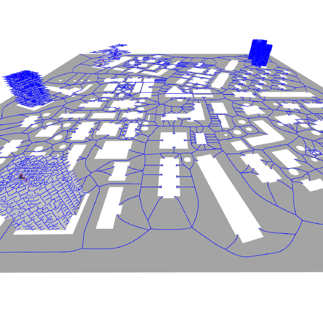
We describe and demonstrate the Explicit Corridor Map (ECM), a navigation mesh for path planning and crowd simulation in virtual environments. For a bounded 2D environment with polygonal obstacles, the ECM is the medial axis of the free space annotated with nearest-obstacle information. It can be used to compute short and smooth paths for disk-shaped characters of any radius. It is also well-defined for multi-layered 3D environments that consist of connected planar layers. We highlight various operations on the ECM, such as dynamic updates, visibility queries, and the computation of paths (indicative routes).
We have implemented the ECM as the basis of a real-time crowd simulation framework with path following and collision avoidance. Our implementation has been successfully used to simulate real-life events involving large crowds of heterogeneous characters. The enclosed demo application displays various features of our software.
@inproceedings{vanToll2016-ECM,
author = {van Toll, W.G. and {Cook IV}, A.F. and van Kreveld, M.J. and Geraerts, R.},
title = {The {E}xplicit {C}orridor {M}ap: Using the Medial Axis for Real-Time Path Planning and Crowd Simulation},
booktitle = {International Computational Geometry Multimedia Exposition},
year = {2016},
pages = {70:1--70:5}
}